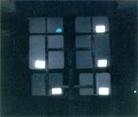
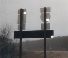
The truth can now be told. Embedded in our nation’s road sign system is a secret coding designed to target vital sites, facilities, routes and resources for military confiscation during a National Emergency. Though, concealed by the lies of the Department of Transportation for many years, “Free Indeed Research” has tapped deeply into one of the most clever, and deceptive cover-up operations to come down the pike in years! (If you think GPS will be working normally in the scenario described herein, think again.)
The United Nations military has plans to become the cop soldiers of the world. Unknown to the general populace, a “Rapid Deployment” force stands ready to enter U.S. borders at the request of the President of the United States during a national emergency. They will perform “peacekeeping” operations such as evacuations, rounding up dissenters, confiscating firearms and incurring facilities and sites for military use. These forces are laced with foreign troops that do not speak English. Therefore, as a tactical advance, all nations have been secretly revamping their roads sign systems to conform to an international standard under the guise of the WTO. It is our belief that these signs and reflective markers “TACMARS” on the backs of many signs are coded to target vital sites, facilities and resources to be confiscated and used by these troops.


How the quadrant sign codes works:
- Signs are divided in half, left and right.
- Markers positioned on the right side, point right.
- Markers on the left side, point left.
- Markers turned on “end” are an arrow “UP” code, signifying a site for pick-up helicopter airlifts
- Marker on top means straight ahead
- Double ended arrow denotes an airlift facility
- 3 arrows denotes a facility
- 2 arrows denote the direction of the operational site
- The coding on the stickers is also used to point to drugstores with passport photo services. Under martial law, this facility may be used for medical care, inoculation/vaccination, and creation of ID cards.
Tacmars’ are used to encode the following:
- Directions to closest military installations
- Directions to closest triage or quarantine facilities
- Facilities with Internet access, for the following purposes: Communications Identification and/or background search of individuals
- Directions to closest detention facilities


