8) Coal mining has shifted from Appalachia to out West
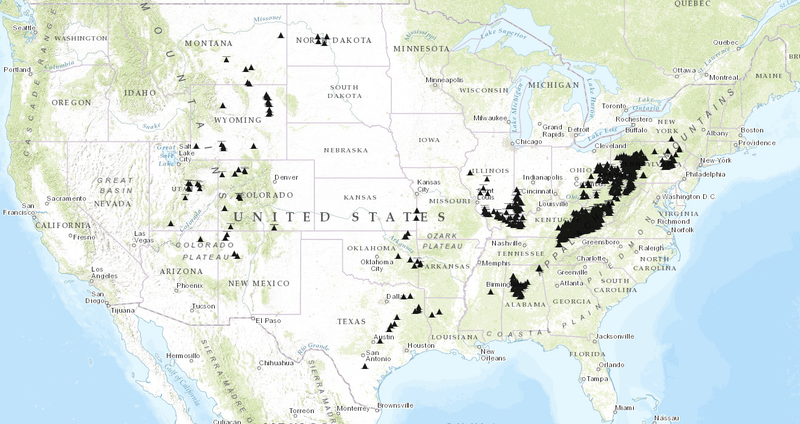
Here’s a map of all the major coal mines in the United States:
 (Energy Information Administration)
Judging by this map alone, you’d get the impression that Appalachia is the center of coal country. But in fact, that’s no longer true. Ever since the late 1990s, the majority of America’s coal has come from west of the Mississippi — particularly from public lands in Wyoming and Montana — rather than from the East.
There are a few reasons for that. The coal out West tends to be lower in sulfur, which is useful for US coal plants that are trying to cut their sulfur dioxide emissions in response to pollution regulations. What’s more, Appalachian states like Kentucky and West Virginiahave already mined much of their easiest-to-reach coal seams — and many areas are seeing a decline in production.
Coal mining is expected to take a further hit in the future as the EPA’s new climate rules lead to a decrease in coal-fired electricity. Some of the coal from Wyoming and elsewhere may start to get exported abroad, though environmentalists have been working to block that export infrastructure, arguing that it’s detrimental to climate efforts.
